Another Friday off from work, so that meant time for another adventure run. My drug of choice this week was the Catskills High Peaks Region - a return trip after a long absence to one of my favorite hiking regions in New York State. I had mapped out a route for the Slide Mountain Wilderness loop, similar to a run I'd done a few years ago. I'd start and finish at the Denning Road Parking Area while traversing Slide, Cornell and Wittenberg Mountains in a counterclockwise direction. The route would include an brief out-and-back to the Terrace Mountain lean-to, (just to see what's there), and an out-and-back up Giant Ledge to the summit of Panther Mountain. From there, I'd return to the car via Oliverea Road and the Phoenicia East Branch Trail. The weather outlook was mostly sunny with a high of 70, so everything was good to go. Coincidentially, this was the same day that I mailed my waiver and entry fee for
Manitou's Revenge, which would be my first trail race in the Catskills. The proposed route also covered most of
Red Newt Racing's Cat's Tail Marathon - a point to point trail race around the Slide Mountain Wilderness.
 |
| Panoramic view from atop Cornell Mountain |
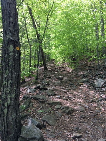
The trail climbs gradually up into the wilderness from the Denning Road Parking Area. The first few miles aren't very technical, and I made a mental note that I'd have a blast later on when running down this stretch to the car. At about 1.2 miles the trail reaches a junction where one can take a right to climb Table and Peakamoose Mountains, two of the Catskills High Peaks. My course split to the left though, following the Long Path, and I continued on to another junction
where I found the Curtis-Ormsbee Monument.
 |
| C-O Monument. PC: Wikipedia. |
The Curtis-Ormsbee Trail is named for William Buckingham Curtis and Alan Ormsbee, a pair of hikers who created the section of trail I would be following for the next mile. In 1900 the two were killed in a snowstorm somewhere in the Presidential Range in New Hampshire, and a small monolith was erected on their trail in memoriam. The monument can be found at the junction of the C-O Trail and Phoenicia East Branch Trail.
The Curtis-Ormsbee Trail briefly overlaps with the Long Path until the latter splits off and heads up Slide Mountain. I followed the trail up Slide and over some steep, treacherous terrain. At 4,180 feet, Slide Mountain is the highest point in the Catskills, and one of only two Catskill peaks that tops 4,000 feet. Atop Slide one may find another tribute - the John Burroughs Monument. Burroughs was an essayist who wrote extensively about nature, philosophy, and literature. He was an avid hiker in the Catskills; some of his works were composed during his long hikes into the High Peaks region, while others were inspired by what he saw and encountered up in the mountains. The Burroughs Monument is a plaque embedded permanently into the vertical face of a large rock. On the plaque is engraved a brief summary of who Burroughs is, followed by a quote from the writer himself. The summit of Slide Mountain has some killer views of the surrounding peaks and valleys, and a spring where I was able to top off my water reserves.
 |
| The John Burroughs Monument |
 |
| Another Burroughs tribute, on the side of Oliverea Road |
 |
| Panoramic view from the top of Wittenberg |
Following the trail up and over Slide leads to the summit of Cornell Mountain, followed by Wittenberg's peak only a short distance further. Descending off Cornell, one must pass through the Cornell Crack - a tricky section of v-shaped rock that is difficult to descend and probably even tougher to climb up. Fortunately, the descent off Cornell and subsequent climb up to Wittenberg is pretty easy once you make short work of the crack. On the descent from Wittenberg, there's a spur trail that leads to a lean-to on Terrace Mountain. I followed this trail to the lean-to just to check out what was there. There turned out to be no views and nothing worth looking at. The National Geographic Trail Illustrated Map that I was carrying has the lean-to as a dead end trail, but per Strava, there's a trail that continues a few miles down to a road. Needless to say I backtracked to the main trail, then made my way down to the Woodland Valley Campsite and across the first paved road of the route.
 |
| The rocky climb up from Woodland Valley |
Woodland Valley was almost like an aid station. In a bathroom with running water I was able to refill my bottles and cool down a bit before the long, grinding climb up and out of the valley. I ran this loop once a few years prior and remembered this part of the trail as a long, endless climb that lacks any viewpoints and is just steep enough to be unrunnable. Three years later and nothing has changed. 13 miles in and the cumulative fatigue started adding up. This assured that the ascent out of Woodland Valley was pretty miserable. I trudged on until coming to a four way junction, where a right turn leads up to Giant Ledge and Panther Mountain. I still felt pretty solid overall and hiked up to Giant Ledge, my favorite spot in all the Catskills.

Giant Ledge boasts several scenic overlooks to the east. On a clear spring day like today, one can see for miles and miles a uniform coat of green treetops rolling up and down the adjacent mountain sides. The bright blue sky, peppered with a handful of fluffy cumulus clouds, provides a lovely contrast to the pine green sea of trees. A cool, refreshing breeze blew in and I was reminded again why I enjoy trail running. The hard work I put in to reach this point was all worth it. Without putting in the work, the reward is taken for granted and becomes meaningless. I thought about this as I continued to the summit of Panther Mountain before turning around to return the way I came.
 |
| Giant Ledge overlook |
 |
| Giant Ledge overlook |
 |
| Giant Ledge overlook |
The trail to Giant Ledge hosts a spring where I refilled my bottles for the last time. I then rejoined the main loop trail and descended to Oliverea Road and back into civilization. The next two miles of the route were on the road before reaching the Slide Mountain parking area. I forgot how tough this road is to run when you've been on your feet for over six hours. I walked the first mile uphill, then ran where the road flattens out and passes Winnisook Lake. Winnisook is an artificial lake located on the grounds of the Winnisook Club, a private area with a group of houses and hiking trails surrounding the lake. Although man-made, Winnisook Lake sits at a higher elevation than any other lake in the Catskills.
At the Slide Mountain Parking Area, I kissed the asphalt goodbye and hopped onto a rocky trail leading back up toward the Slide summit. At some point I either took a wrong turn or simply miscalculated the mileage. It was almost heartbreaking to find a sign reading " Denning Road PA - 3.8." I was exhausted and thought for sure it was only a mile back to the car. To make things worse, it was nearly dark, and I'd need to really hustle to get to Binghamton in time to shower, eat something for dinner, and arrive at work by 11:00 pm.
A mile and a half up from the Slide Mountain Parking Area I reached the junction with the C-O Monument, marking the end of the loop section. The remaining three miles was a runnable downhill straight to the car - the same trail I'd come up seven hours earlier. I took the liberty of practicing my downhill speed on tired legs and made it to the car well before dark.
 |
| Looking at Slide Mountain from the summit of Cornell. |


Pete, this sounds like a great adventure! Scott and Xander hiked Wittenberg last year with Boy Scouts!!
ReplyDeleteNice run report and beautiful pictures :)